Drone technologies and applications are quickly evolving and it is useful to take stock of the new equipment, sensors, and capabilities. What are some of the new directions and new developments that we are seeing with drones? What are some of the threats? Welcome to an interview with Kelly Coble of BCAeronautics in which he discusses how his company is incorporating changes to improve oil and gas exploration and production.
What is your name and your relationship to drones
I am Kelly Coble. I am the Owner and Vice President of Operations at BCAERONAUTICS, LLC. My team is comprised of Franz Willette, Owner and Vice President of Technical Operations, and Aaron Alam, ATP and Chief Pilot. We are joined silently by three other commercial aviators and one retired NASA engineer. Our collective experience spans three decades and ranges from RC airplanes to airline operations and Air Traffic Systems Ground Control / Air Traffic Control to ATP rated pilots. BCAERONAUTICS became a commercial reality in response to the Oil and Gas boom that ended in 2015 and the identifiable need to provide enhanced safety, affordability, and universal accessibility in regard to aerially acquired data. We are an sUAS (DRONE) service provider built on the triad of fundamental values mentioned above. We were one of the first service providers in the Houston Metro Area to receive a section 333 exemption and we are part 107 compliant.
What are some of your areas of specialization?
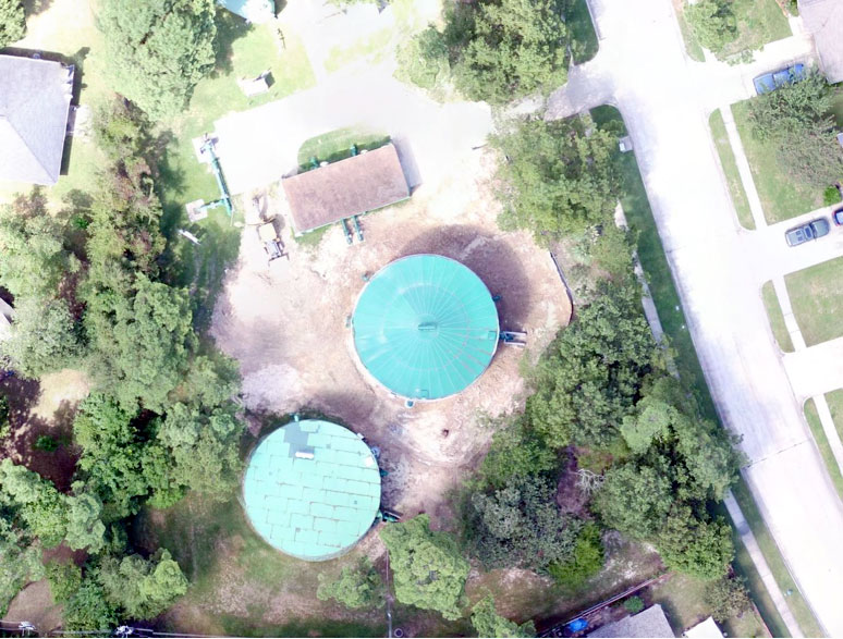
BCAERONAUTICS specializes in the aviation aspects of accessing the National Airspace System and taking full advantage of the opportunities with regard to safety, affordability, and accessibility now possible under the regulatory framework recently enacted. Aerial Mapping, much like that available on the internet but extraordinarily more accurate (by several orders of magnitude), has become a unintended specialty in the wake of the downturn in Oil and Gas. We are capable of mapping in a single operation at an accuracy of 2 cm/pixel over tracts of land as large as hundreds of acres or as small as a roof.
Please describe two drone surveys or projects that turned out well.
We participated in a pipeline survey over 10 months that proved to be extremely commercially viable on our end and actually replaced manned aircraft survey on our client's end. Weekly operations that produced 2D orthomosaic photo pans led to greatly enhanced project management metrics. We have several ongoing projects in Oil and Gas that we are currently not permitted to discuss due to NDAs. Suffice it to say we are actively involved in leveraging the safest and most affordable aerial data in the history of aviation to the oil field from exploration to non destructive testing and project management at the refinery. Real estate and roofing inspection have also provided ongoing commercial interest. The perspectives offered by aerial photography are unmatched from a marketing standpoint and the affordability provided by small unmanned aerial systems has really opened the doors for a promising future with regard to single home aerial survey.
What kinds of sensors do you use?
Inspections and security for lease operations.
The most commercially active payloads we carry are optical cameras. The camera technology we employ is improving at lightning speed. We also have access to infrared and thermal sensors with thermal being the most promising upcoming opportunity. We are also partnered with two educational institutions and one commercial producer of thermal imaging technology for the purposes of identifying methane without the need to use "sniffers".
What kind of drones do you use?
We specialize in the flight aspect of Drone service and are proud to say that we have experience flying a wide array of aerial platforms. Our most commercially active sUASs have been DJI products and optical cameras. The mapping capabilities possible with 4K lossless raw video/photo capture coupled with the GPS interfacing available has revolutionized aerial mapping. Promotional photography of job sites is generally the initial client draw to our service. The possibilities for technical mapping and measurement from the aerial perspective are what drive repeat operations and invariably lead to further commercial conversation and interest.
How do you process your data?
Data security and privacy are at the core of what we provide. We offer a secure client login where we can host large data for easy access and storage. We have paid for and used a long list of service providers for data with varying results. DroneDeploy has time and time again been a "go to" service for 3D models and 2D maps and we are generally inclined to offer our services and capabilities with their processing in mind. Every project is of course unique and not all services are available on a single project basis. One aspiration for BCAERONAUTICS is to develop an end user centric chain of data processing that allows the customer to really drive the levels of security and actionable capability of data use and storage.
What are your plans for the future?
There have been two major obstacles to our nascent industry. First, everyone with a credit card can have a drone. There have been real threats to manned aircraft safety due to incursions into controlled airspace because of operators who fall under the "its just a toy" paradigm.
There are also countless professionals from other unrelated industries who use personal drones for the acquisition of aerial data with no regard for the legality of such action. These aspects of this industry obviously pose a threat to safety but have also had the effect of softening commercial interest by adding to the supply of available operators as many prospective consumers of drone services are unaware of the regulatory limitations.
Second, this nascent industry has some indicators of historical relation to the early aviation industry and the automobile industry. In the earliest days of manned aircraft flight only the most daring got behind the controls and their brave passengers soon followed. The regulatory body that is today the Federal Aviation Regulations were by in large written in their blood. Much of the safety we enjoy and take for granted today in aviation grew from their mistakes and the unfettered access possible at that time to the National Airspace System.
With regards to the automobile industry: horse drawn coaches and buggies were a transportation imperative. When the novel automobile was introduced it was met with a market that had seen the sun rise each day before it existed and had never needed to go 30 miles per hour or drive to town more than once a day. Obviously, the "motorcoach" made short work of the competition and has created a complex culture of transportation of which it is an anchor tenant. These aspects of this industry underly the difficulties of motivating change and identifying consumer wants and needs and how an innovative technology can struggle at first only to find the sky really is the limit.
BCAERONAUTICS plans to play a role in upholding safety and avoiding some of the pitfalls we thankfully can reference historically. We shall also endeavor tirelessly to bring the needs of our customers to light and show that the affordability and accessibility now possible is truly game changing.
Please visit www.bcaeronautics.com/advanced and our youtube channel have some recent promotional content.
Don't miss the AAPG workshop